260 miles, 11.5 days. That's a Wrap Collegiate West.
- Aug 16, 2019
- 14 min read

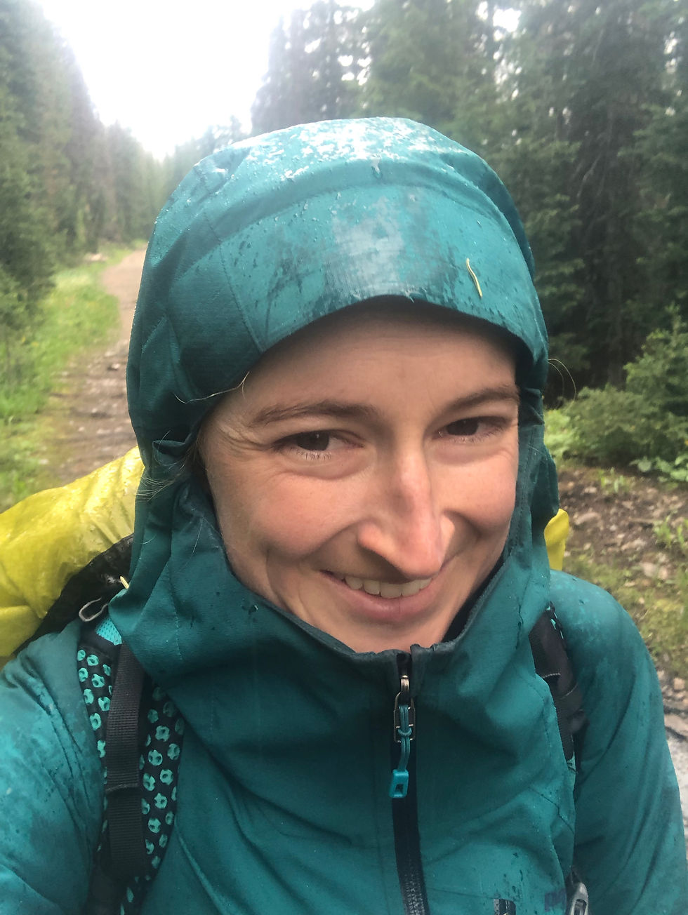
CT Day 11: 24.6 miles hiked. Camping just past stream @ 7.3mi in CW segment 3 to Middle Fork South Arkansas River (CW 05 trailhead) (elev: 10,440 ft).
I finally had a decent night’s sleep! I seriously think it’s the Pure Power that Robbie gave me. I didn’t wake up in serious pain, just tossed and turned slightly adjusting my layers with the temperature. It’s been dipping down into the upper 30s at night and I’m usually quite cold at first, but then get a little warm so I shed some layers. By dawn I’m cold again. I also think that sleeping at such high altitude (above 10k ft usually) causes for more restless and light sleep.

I woke up around 6:00 am and had the most AMAZING view for my morning pee. The sunrise painted the sky all sorts of purple and blue and it was seriously just stunning. Since we camped above tree line, the views at our tent site were vast and breathtaking (literally!).
I packed up my stuff and the three of us (Red Stripe, Stix and I) hit the trail. We had two pretty brutal climbs in the morning. The second one being so steep and probably our highest elevation point in the CW at 12,868 ft.
We had a nice long descent from the high point of the day and Red Stripe and Stix were ready for a lunch break at the stream in the valley at the bottom. It was only 11:30 am and we decided that we would try to knock out 25 instead of 20 miles today so that we could be even closer to Monarch Pass the following day. We planned to get off trail at Monarch Pass/Salida and the earlier we got off trail, the sooner we could be eating real food and get to Denver to begin our trail intermission.
If we were going to do 25 miles, that still meant we had 16 more miles to complete that afternoon! Usually I like lunch to be around a halfway mark, and 16 more Collegiate West miles felt like a daunting goal. We still had three more passes to hike up and over and the afternoon weather is always a risk factor. Two older men that were section hiking the CW warned us not to dilly dally too much at lunch because the storm clouds should be rolling in soon.
Every day other hikers anxiously warm us about the weather: “The forecast has storms for the afternoon!” Or “the next 5 days look like they will be very wet!” I stopped looking at the forecast after day 1 when I realized it just didn’t matter. The weather changes SO quickly and dramatically in the mountains and it depends if you’re on the north or south side of the mountain at the time of the storm and the wind could be blowing the storm forcefully in one direction, hit the mountain and change directions completely. Not to mention, being in the mountains in Colorado summers means there is ALWAYS a chance for a storm in the afternoon. We knew this, we were prepared for this, and it never impacted our hiking decisions, so why bother fretting?
We had some emergency procedures and plans in place. If we were above tree line and there was threat of lightning, we would collapse our poles and run down or if it was imminent we would ditch the poles and put my sleeping pad over our bodies and rain fly over us and get low (lay down or crouch). If there was hail and we were below tree line or lightning wasn’t a factor we would do “tent drill” which involved us setting up a tent really fast. Red Stripe would take the feet of the tent and I would take the head of the tent and we would set it up quickly and both get in it to stay sheltered from the hail. Now that Stix was with us we could also use his homemade footprint (garbage bag with grommets - genius!) and his and Red Stripe’s adjustable hiking poles to make a quick shelter if needed for us to crouch under (assuming no lightning).
Anyway - I left the stress of the weather behind me in the southern states of the Appalachian Trail and knew that nothing I would face in Colorado could be as bad. Even if everything got completely soaked somehow, the dry mountain air would dry it out in a few hours. We weren’t about to start rushing our hike or our nice relaxing breaks to try and “beat the storm” because it would be futile. We trusted that we were fast enough to run if we needed to and we were out there to chill, not let potential weather interfere with the chill vibes.
If it had been lunch time on the AT and we still had 16 very mountainous miles ahead of us for the day, I definitely would have rushed through lunch and started hiking with some amount of haste to ensure I could make it. I now felt a new wave of confidence on the CT and could relax into our hike more than I ever could on the AT. On the AT there was always a sense of urgency - trying to catch up or keep up with my hiking partner or get in the day’s miles before dark. I didn’t fully trust myself yet as a hiker/athlete during my AT thru hike. There was always an inkling of doubt lurking in the background that caused some chronic stress/anxiety in the day to day. On the AT, I usually woke up early and hit the trail, hardly took breaks, and couldn’t fully feel relaxed until I arrived at the day’s end point and could take off my shoes. But then usually I would look at what the next day had in store and anxiously try to sleep so I could do it all over again. It was exhausting. Anxiety simmering on the back burner because of a lack of self confidence took its toll. I don’t even think I was fully aware of it then until its absence now. I also don’t think this is something that men deal with as much as women. Knowing that so few women are actually able to complete the AT as a thru hike plus the set of doubtful gremlins society entrenches in our subconscious from the time we are very little girls telling us we aren’t as strong as men, played its role in my hike on the AT. What made me so special that I would be one of the few to finish? Nothing! Only 20% of AT thru hikers finish, and of those finishers only 20% are women. That’s a very small percentage!
Now that I was totally self sufficient and not relying on anyone for anything and had a brave, strong, and super chill trail companion in Red Stripe, I could feel that my confidence was growing to a place I never even knew was possible. To date, we hadn’t met any hikers that had thrown down as many miles as we had since their start date. We started on July 20th and most people we met started 1-2 weeks before us. We started noticing that most people hiked half as many daily miles as we were. These stats don’t actually mean too much as we are pretty experienced hikers, but it boosted our confidence for sure and helped us say out loud to each other that we were rocking!
The gremlins of doubt in the back of my mind were as quiet as they had ever been. I didn’t know that it was even possible to feel this way - so carefree, yet so strong and ambitious at the same time. I felt a cool confidence mixed with a healthy dose of humility, but minus the self doubt or anxiety that usually accompanies ambitious feats.
We began our big climb after lunch. We cruised up the piney switchbacks and started noticing the clouds overhead. Just as we reached the top of the switchbacks below tree line we felt the cool breeze of a storm and in a matter of seconds we got a few drops of rain on us. The sprinkling rain only lasted about 30 seconds before it turned into pea-sized hail. Right when I said to Stix “oh shit, it’s hailing!” Red Stripe shouted from the switchback below “it’s hailing! Tent drill!” We never knew if the hail or storm would get worse, so we agreed that if there was hail we would set up shelter in case it got much worse. By the time Red Stripe rounded the corner of the switchback and I had my tent out of my bag, we looked at each other and realized it was letting up quickly. The hail only lasted a few minutes, and we were back in sunny skies.


We were right on the outskirts of the storm and we were headed into the sun and the storm seemed to me moving in the opposite direction we were. I put the tent away and we decided to head for the double pass. It would be quite a few miles above tree line but the weather seemed clear enough to make a go for it. We filled up on water and headed up. The first pass was beautiful and easy. The second pass was higher and steeper and a bit more challenging. We relaxed at the top and as we started to head down we realized that there was a pretty serious snow patch covering the trail on the south side of the mountain. We crossed the patch following the footsteps before us. It was a long and sketchy patch. Then the trail was lost under the snow and we had to use Guthook maps to figure out which direction to head in. We were scrambling in a loose boulder field around the snow and pretty far off trail. It was steep and we needed to use our hands to scramble. The clouds and storms still lingered nearby, but luckily between the three of us we were able to collaborate on route finding and make a plan of action to get back on the trail by cutting all the way to the left instead of heading straight down to intercept a switchback at the bottom of the long and steep boulder field.


We made it to the trees, and not too long after we started to get some rain from a different storm system. We couldn’t have been luckier to get through the exposed boulder scramble without any rain or wind. Now that we were in the pine trees again the trail turned to an old railroad bed so it was smooth and gentle and easy terrain. It started to get pretty cold so I pulled over underneath a pine tree where it was totally dry and put on my puffy jacket underneath my rain jacket. This combo is always so good because the warmth from my body keeps the puffy dry and keeps my rain jacket way more dry than if it were just on my skin. I stayed in shorts so I could change into dry pants later, but once my core was dry and warm with my puffy jacket the rest of my body was fine. I find that my leg skin dries way faster than if I had hiking pants on and I hate having to deal with wet clothing.

We experienced light rain for the duration of the 3 mile railroad bed descent, but it was never enough to have wet feet and there were always dry patches on my rain jacket. Compared with the AT, we could barely consider this actual rain.
We stopped at the bottom of the descent under a dry pine tree grove and had a snack break. The rain let up but it was still cold and overcast/wet. After eating and drinking we headed out on a gravel Jeep road for about 1.5 miles until we got to a parking area. The road section was poorly marked and we were so grateful to have the app Guthook to help us stay on route. So many people out there carry a little data book, which has some good info, but ultimately Guthook saved us with route finding countless times out there. Red Stripe and I are totally hooked on Guthook and it saves us a lot of energy and worry because it shows your location and direction in relation to the trail.
It’s a life saver out there!


When we got to the exposed parking lot we could see up at our last pass of the day. It was cold and windy and we knew there was no chance of us taking any group breaks on our way up or down this very exposed section. We usually regroup at the top together or if there are any sketchy sections. This time we agreed to just meet in a sheltered spot on the other side and just move at our own paces.
I headed out first, Stix hiked in the middle and then Red Stripe. She had been having more trouble breathing in the last few days so the steep inclines above 12k ft required more breaks to bring her heart rate down. The first mile was flat and marshy/muddy and sort of reminded me of the bogs in Maine on the AT. I somehow managed to skirt and hop around most of the super thick and stinky mud pits and my socks and feet stayed pretty dry. Kind of a miracle. I definitely had mud splatter on my bare legs though.
The climb was only 0.5 mile but it was SO STEEP! It took a while to slowly march up to the top. The descent was the same - so steep. There were a few snow patches that were a little scary and a boulder field that luckily had cairns (some rock fields the day before didn’t have cairns).
Finally we reached tree line and took a group break. What a TOUGH two miles! I put on my dry pants and ate a lemon poppyseed Bobo’s bar (my favorite flavor!)
We only had 4.5 miles remaining until our camp spot and only one more 0.5 mile climb sort of near the bottom. The climb didn’t seem particularly steep, but I knew I would feel it because my legs and body were tired after such a long push.
By the time we got to the Arkansas River in the gap we finally saw other people. We could smell a campfire and see other tents. Seeing a little camping area felt so comforting and we were so excited to be done for the day! I cooked before setting up my tent so that Red Stripe I could stagger my fuel usage. Her fuel ran out yesterday, which was a surprise as it seemed to go faster than we expected. I use a wind screen and am pretty conscientious to add my food when there are bubbles on the bottom of the pot (instead of waiting for a roaring boil). I think these two things eeked out some extra life in my camp fuel so we were able to share it. I actually loved cooking before setting up my tent because my rice and beans need to sit covered for 5-10 minutes for it to fully cook. While I was waiting I set up my tent and then once I was done setting up my food was ready. I’m also a slower eater than Stix and Red Stripe so we finished eating around the same time.
We decided to get an early start the next morning so we could get off trail by like 11 am. We only had 10.6 miles left, but we had an ominous climb right away in the morning. We retired to our tents right after eating and for the first time I didn’t even journal at night. I had no energy left so I just changed into my sleep clothes and got warm. I was on a little bit of a slant so I ended up sleeping on my sides and tossing and turning quite a bit all night, but thanks to the Pure Power “Power Down” supplements I didn’t have achy legs!
I started my period this morning which I was bummed about. I took CBD oil and was running out of Aleve but Red Stripe had some extra she gave me for sleeping. It really sucked to have to deal with this extra burden on trail. The hip belt on my pack was nearly impossibly to use because it felt like it was squeezing my uterus. This meant I was carrying most of the load on my shoulders while the cramps are bad which make it extra difficult. Not to mention, the need for extra hydration, extra fatigue, and some moodiness. I became pretty open about having my period on trail with some of the male hikers on the AT because I felt that if I had to go through it, it made sense for others to at least know about it. If it made them at all uncomfortable, then they might have experienced a tiny fraction of the discomfort I was actually feeling.
Tomorrow is a near-o day to Monarch pass where we will get off trail for a short trail intermission to deal with the real world demands that face us. We’ll take Stix to Salida to resupply and Red Strip and I will head to Denver to fly home for 4 days.
CT Day 12: Near-o day. 11 miles. Middle Fork South Arkansas River (CW 05 trailhead) to hwy 50 at Monarch Pass (elev: 11,300 ft)
We got a VERY early start as we wanted to maximize our time off trail to work on logistics and get to Denver. We were on trail hiking at 5:30 am and I had to use my headlamp for a little while. We were surprised that it was still so dark at 5:30 am, but I guess the days are beginning to get a little shorter.
We had a very steep and long climb right off the bat. I would say it was our steepest and most challenging climb thus far. We had a beautiful clearing just when the sun was rising and it was pretty spectacular to stop and watch for a little bit.
The climb was steep. Just so steep. Did I mention the climb was STEEP?! The very last bit got even steeper and the top was a vertical section in snow that felt like climbing a snow ladder. It was pretty scary and I was just glad I was going up and not down. I don’t think I could have climbed down that section. At one point I looked ahead and realized that it was a longer section than I thought it was going to be. I glanced to the side and realized I needed to focus on my feet, just one foot in front of the other. I couldn’t take my eyes off my feet or lose focus from the careful placement my feet and poles.
Once we got to the pass at the top we took a decent break. It was soooo windy though and very difficult to shelter ourselves from the wind. We had a bit of cell service for the first time in 5 days or so, but it was so cold I could barely take my hands out of my gloves to use my phone.
We plowed forward in the wind and I think I got wind burned on my cheeks and lips. The 5ish mile ridge walk was stunning and well above tree line (and no water), but it was windy so we had to forge ahead.

When we got to Monarch ski resort I knew we had to be super close to the road and trailhead where we were meeting my dad. We walked up the Great Divide ski run that is a blue I have skied many times before. It was a steep 0.5 mile push up. Then we took a green run down. Once we were down I thought we would be arriving at the road, but alas we still had 2.5 miles left! Ugh! It wore on and we were ready to be done. We were power hiking and just getting it done through the pine forest.
Finally we got to the road and we saw my dad! Yesss! We wasted no time and hopped into the car. We drove Stix to his hostel in Salida and grabbed lunch at Amica’s pizza and brewery (they had vegan cheese for their pizzas or paninis)!

We then hit the road to Denver.
Trail Intermission: 4 days

We got off trail for logistical reasons to deal with some pressing things in our personal & work lives. This was always the plan. It’s not ideal to get off trail in the middle of a thru hike because the transition back to society can be overwhelming and stressful when done in a haste. We knew we would have to deal with this, but that didn’t make it easy.
A highlight from this trail intermission was doing a live podcast with Robbie Balenger and Chris McClung (owner of Rogue Running). Give it a listen on the Running Rogue podcast!

Prepping for getting back on trail while OFF trail and in the middle of a different world was also challenging and overwhelming, but we did it! We made plans to get back on trail after only a 4 day hiatus.


Comments